 Scenic places
Neelum Valley: a travel guide to Azad Kashmir's greenest valley
TourScope team · 19 November 2026 · 7 min read
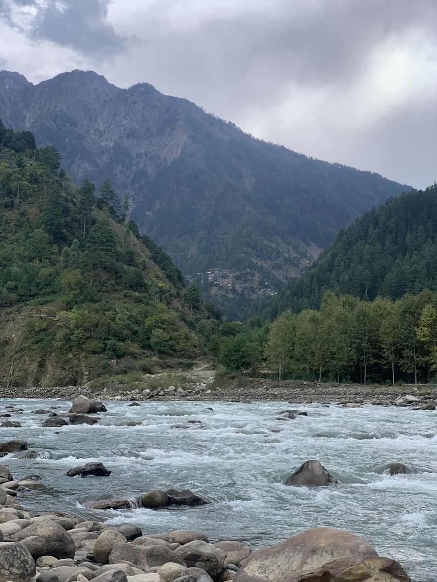
Photo: adil amin / Unsplash
Pine forests, a blue-green river and meadows like Arang Kel. How to reach Neelum Valley from Islamabad, the best stops from Kutton to Taobat, when to go and what to know about travelling near the Line of Control.
Green slopes covered in pine and fir, a fast blue-green river, wooden villages and meadows high above the road: Neelum Valley is the best-known valley in Azad Jammu and Kashmir, and for many Pakistani families it is the classic summer escape. It also runs right alongside the Line of Control, which shapes how you travel there.
Where is Neelum Valley?
Neelum Valley follows the Neelum River, known as the Kishanganga on the Indian side, through Neelum District, the northernmost and largest district of AJK. The river comes down from the Gurez area and meets the Jhelum at Muzaffarabad.
The road climbs north-east from Muzaffarabad through Athmuqam, the district headquarters, past Keran and Sharda to Kel, and finally to Taobat, the last village before the Line of Control. Sources give the valley's length as anywhere from about 140 to 200 km. Villages sit at roughly 1,200 to 2,300 metres, with peaks well above 5,000 metres.
Getting there
- Islamabad to Muzaffarabad: usually around three to four hours, via Murree and Kohala. Many travellers spend the first night in Muzaffarabad.
- Muzaffarabad to Athmuqam and Keran: the main Neelum road is paved for most of this stretch. Allow roughly three to four hours to Keran, more with traffic and photo stops.
- On to Sharda: expect a long day's drive from Muzaffarabad. The road is narrow and winding, and times stretch in peak season.
- Sharda to Kel: around 20 km, usually one to one and a half hours. The surface gets rougher the higher you go.
- Kel to Taobat: a little over 40 km, but on a narrow, unpaved jeep track that can take four or five hours each way. Ordinary cars and vans are not suitable.
A common approach is to drive your own car or a hired van as far as Sharda or Kel, then hire a local jeep for the upper valley, Taobat and side trips such as Ratti Gali. Jeeps are usually hired by the day; agree the price, route and number of days before you set off.
Landslides and road closures
The Neelum road is prone to landslides and rockfalls, especially after heavy rain and during the spring thaw. In 2026 alone, slides closed the road for hours or days at a time at spots including Sheikh Bela and near Kel. Build a spare day into your plans, avoid driving in heavy rain and check our Road news page before you set off.
Places to see along the valley
Kutton and the Jagran valley
Near Kundal Shahi, a side road turns off up the Jagran valley to Kutton, a small resort village among pine forest. The waterfall and rushing water of the Jagran stream make it a popular first stop, and it is close enough to Muzaffarabad for a day trip.
Keran
At Keran the river itself forms the Line of Control, and the village on the far bank, also called Keran, is on the Indian-administered side. It is a popular place to break the journey, but remember you are looking across a militarised frontier.
Upper Neelum
Upper Neelum is a hillside village above the main road near Keran, with wide views over the river, terraced fields and forested slopes.
Sharda and the Sharda Peeth ruins
Sharda is a small town in a wide, open part of the valley at about 2,000 metres. Just outside it are the ruins of Sharada Peeth, an ancient Hindu temple and seat of learning. Between roughly the 6th and 12th centuries it was one of the great temple universities of South Asia, and the Sharada script is named after it. Today it stands roofless on a hillside. It remains sacred to Kashmiri Pandits, so treat it as you would any place of worship.
Kel and Arang Kel
Kel is the base for Arang Kel, a meadow village on a shelf high above it. To get there you cross the gorge by chairlift (cable car), then walk up a steep path through the forest. Most people take somewhere between 40 minutes and two hours on the climb, depending on fitness, and you can also walk all the way from Kel. At the top, wooden houses are scattered across a sloping green meadow ringed by forest.
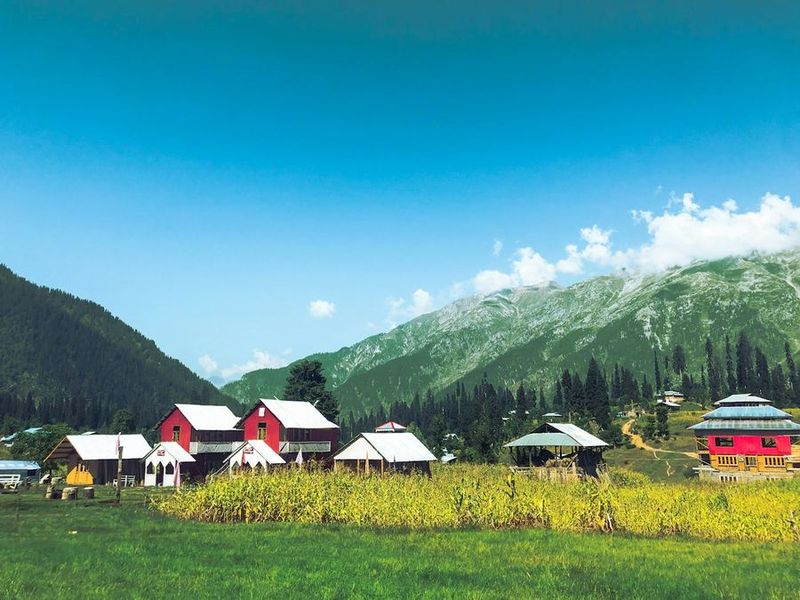
Check whether the lift is running before you plan your day. Wear proper shoes, as the path can be muddy and slippery after rain.
Taobat
Taobat, at about 2,280 metres, is the last village on the road and sits very close to the Line of Control. It has wooden houses and a small bazaar. Many guest houses are on the far side of a long footbridge that jeeps cannot cross, so expect to walk your luggage over. Facilities are basic. Expect identity checks on the way: travellers have reported officials at the Hilmat checkpost holding ID cards until their return.
Ratti Gali Lake
Ratti Gali Lake is a glacial lake at around 3,680 metres, reached from Dowarian on the main road between Keran and Sharda. Jeeps take visitors up a rough track towards a base camp, and you walk the last stretch to the lake. Allow a full day, and go with a reliable local driver or guide.
Line of Control: what to know
For much of its length the Neelum road runs close to the Line of Control with Indian-administered Kashmir, and in places the river itself is the boundary. The valley has a long history of cross-border firing. In May 2025, during the Pakistan–India clashes, authorities turned tourists back from the valley for a time and homes in Neelum were damaged. The ban was lifted in mid-May 2025 and the ceasefire has since held, but the situation can change quickly.
- Follow local instructions at checkposts and carry your ID at all times (CNIC for Pakistanis, passport and visa for foreign nationals).
- Never photograph military posts, soldiers or installations, and do not fly drones.
- Stay on the road and marked paths. Unexploded shells from past firing have been found near the LoC.
- If you are told to turn back, do so.
Foreign visitors
Rules for foreigners in AJK have changed several times. In the past, foreign nationals needed a No Objection Certificate (NOC) from the Ministry of Interior to visit parts of AJK, including Neelum. There have been reports that this was relaxed, but we could not confirm the 2026 position, and areas near the LoC may stay restricted either way. At the time of writing, the UK also advises against all travel within 10 miles of the Line of Control, which covers much of the Neelum road and can affect your travel insurance. Confirm the current rules with the authorities or a licensed tour company before you plan anything. Our guide to planning a first trip to northern Pakistan has more general advice.
When to go
- May to October is the season. May and June are fresh and green, July and August are busiest, and September and October are quieter, with clear days and cool nights.
- July to September is the best time for Ratti Gali and other high spots.
- Monsoon rain in July and August brings the most landslides on the road.
- Winter (roughly December to March) brings heavy snow. The upper valley can be cut off and many guest houses close. Only travel in winter with up-to-date local advice, and see our winter travel guide.
Where to stay
Most accommodation is in small private hotels and guest houses, clustered at Kutton, Keran, Sharda, Kel, Arang Kel and Taobat. Rooms are simple, and the higher you go, the more basic they get. The AJK Tourism Department has rest houses in places such as Keran and Sharda, some run by private operators, so check their condition and booking arrangements first. In July, August and on long weekends, book ahead or arrive early in the day.
Practical tips
- Mobile signal: most networks fade out as you go up the valley. The army-run SCOM network usually has the best coverage, and SCOM SIMs are normally bought in Muzaffarabad. Hotel Wi-Fi, where it exists, is slow.
- Cash: carry enough cash from Muzaffarabad for your whole trip, including jeep hire. Do not rely on ATMs or card payments in the upper valley.
- Supplies: shops thin out after Sharda, so stock up at Kel or before.
- Etiquette: Neelum is a conservative, mostly rural area. Dress modestly, ask before photographing people (especially women), and keep noise down in villages at night.
- Litter: take your rubbish back with you.
Plan your trip
Many tour companies on TourScope run trips to Neelum, from short Kutton and Keran breaks to longer tours up to Arang Kel and Taobat. Use our tour matcher to compare them, or browse companies touring Kashmir. If you are also thinking of the Kaghan side, read our guide to Naran, Kaghan and Lake Saiful Muluk. Before you go, check Road news for the latest on landslides and closures.
Photo credits
Cover: stream through fir forest near Sharda by adil amin via Unsplash. Arang Kel: wooden houses on the meadow by Shehzy Alam via Unsplash.